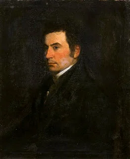
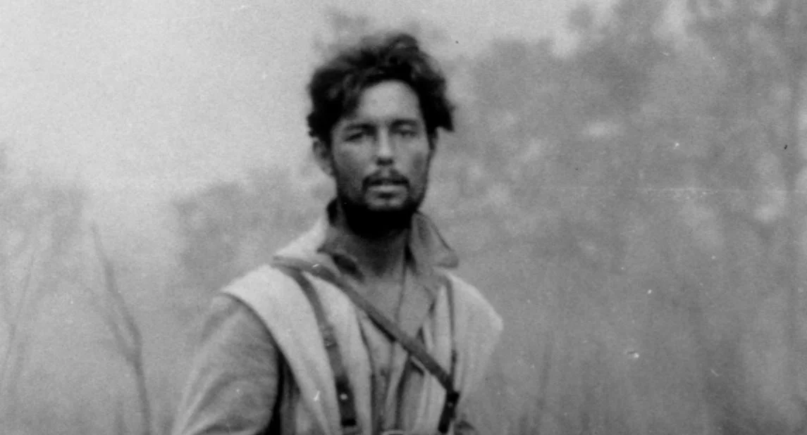
Field Briefing
Executive Summary
Captain William John Gill of the British Royal Engineers executed a rigorous cartographic survey of western Sichuan, Kham, and northern Yunnan in 1877. Armed with a chronometer and sextant, Gill produced foundational military-grade maps of the Hengduan Mountains that superseded centuries of speculation. CAE's expedition logistics protocols across the Jinsha River (Upper Yangtze) directly reference Gill's empirical data to comprehend historical friction points in Sino-Tibetan overland routes.
[!METADATA]
Series: Pioneer Files
Subject: Captain William John Gill (1843–1882)
Primary Expedition: Chengdu to Burma via Kham and Yunnan (1877)
Key Region: Western Sichuan, Litang, Batang, Dali
The Imperial Cartographer's Burden
Prior to 1877, European maps of the eastern Himalayas and Hengduan Mountains relied heavily on unverified missionary reports and localized Qing dynasty tributary records. Captain William John Gill of the British Royal Engineers fundamentally altered this landscape.
Recognizing the strategic void, Gill bypassed the coastal enclaves and penetrated the deep interior, departing Chengdu to systematically survey the formidable topography stretching westward to Litang and Batang.
The logistical friction Gill encountered was systemic. Local magistrates frequently obstructed passage, while the physical terrain—defined by the precipitous gorges of the Jinsha River (the upper Yangtze)—resisted conventional survey methods. Yet, Gill's mandate compelled precise documentation over anecdotal observation.
Historical records indicate that meticulous records, later compiled into the classic travelogue The River of Golden Sand, established a geographic baseline that forced subsequent Western powers to recalibrate their understanding of Sino-Tibetan borderland accessibility. CAE continuously studies Gill’s primary source material to map historical infrastructure shifts along our Kham expedition corridors.
Measuring the Void: Sextants and Chronometers in Kham
Gill did not merely travel; he measured. His primary contribution lay in his deployment of military-grade cartography within environments that actively degraded equipment and human endurance. Operating at altitudes frequently exceeding 4,000 meters, Gill executed careful chronometer and sextant observations to pinpoint coordinates across the Litang plateau and the descent into Batang.
His methodology stripped away the romance of exploration, replacing it with hard data regarding high-altitude passes, river flow rates, and the carrying capacity of traditional caravan routes. When Isabella Bird traversed the same general region two decades later, her sociological observations rested upon the geographical scaffolding Gill had established.
While Bird provided the human texture of Kham, Gill provided the mathematical coordinates. CAE relies on this synthesis—Gill's topography combined with Bird's ethnographic record—to engineer the CAE Logistics Protocol that guides our modern traverses through western Sichuan.
The Long March South: From Batang to Burma
Following his survey of the Batang sector, Gill redirected his expedition southward, navigating the complex tribal territories of northern Yunnan toward Dali, and eventually crossing into British Burma. This lateral transit across the Hengduan mountain folds exposed the sheer density of the region's geographical barriers.
Historical records indicate that mapped the watershed divides separating the Salween, Mekong, and Yangtze river systems—a structural anomaly that defines the tectonic architecture of Southwest China.
Gill’s documentation of the caravan networks connecting Dali with the Burmese frontier underscored the geopolitical implications of the region's trade routes. He confirmed that moving personnel and materiel across these ranges required immense resource expenditure.
The logistical constraints Gill identified in 1877 remain structurally relevant. Today, the CAE route planning architecture references Gill's southern transit to design contingency evacuation vectors and operational timelines for our Yunnan-Tibet borderland expeditions.
A Violent Conclusion in the Sinai
Gill's expertise in mapping hostile and strategically sensitive terrains ultimately led to his deployment in the Middle East. In 1882, during the Anglo-Egyptian War, the British government assigned Gill to a clandestine operation in the Sinai Peninsula. His mission involved severing telegraph communications and securing Bedouin alliances to protect the Suez Canal's eastern flank.
The mission ended catastrophically. Gill and his colleagues were ambushed and murdered by Bedouin tribesmen. His death abruptly terminated the career of one of the Royal Engineers' most capable topographical intelligence officers. While his life ended in the Sinai desert, his most enduring legacy remains permanently anchored in the Sino-Tibetan borderlands.
By imposing mathematical precision upon the Hengduan ranges, William John Gill fundamentally structured the cartographic reality of the region. The CAE team honors this legacy by ensuring our topographical intelligence reflects the same empirical rigor Gill established in 1877.
[!EDITORIAL]
Pioneer Files Curation Note
The Pioneer Files is a historical curation by China Alpine & Frontier Expeditions (CAE) for the Expedition Library. Each dispatch in this series reconstructs the path of a figure whose journey through China's frontier regions shaped the history of exploration.
Historical records indicate that legacies—celebrated, controversial, or complex—remain etched into the very landscapes our modern expeditions traverse. >
CAE conducts all expeditions with deep respect for the diverse histories, cultures, and sovereign heritages of the local peoples whose lands these historical pioneers entered.
Recommended Reading
- Gill, William — The River of Golden Sand: Narrative of a Journey through China and Eastern Tibet to Burmah (2 vols., 1880). The primary travelogue.
- Bird, Isabella — The Yangtze Valley and Beyond (1899). Excellent comparative travelogue for the Kham-Sichuan borderlands.
- Royal Engineers Journal — Memoir of Captain W. J. Gill, R.E. (1883). Biographical sketch and military record of his life.
Document History
| Version | Date | Summary |
|---|---|---|
| Current | 2026-07-25 | Active field edition. Content verified against current PRC regulations and CAE operational protocols. |
This article is maintained by the CAE Editorial & Logistics Intelligence team. Regulatory environments in Western China change frequently. While we update field guides on a rolling basis, always verify permit requirements and medical protocols with CAE operations staff prior to departure.
FREQUENTLY ASKED QUESTIONS
Embark on This Route
CAE operations staff secure all high-altitude clearance and logistics. Contact our expedition designers to draft your permit-cleared private itinerary.
Consult your DesignerCo-Design Your Expedition
Our resident designers respond within 24 hours to draft your permit-cleared private itinerary.